
25. Ice and Climate Change
GG 140: The Atmosphere, the Ocean, and Environmental Change

Lecture 25.?Ice and Climate Change

https://oyc.yale.edu/geology-and-geophysics/gg-140/lecture-25

Mountain Glaciers [00:00:00]
I wanted to remind you about the definition of a tidewater glacier. That's when a glacier comes down to the sea so that pieces can break off and form icebergs.?An interesting set of glaciers is the North and South Patagonian Icefields down in the Southern Andes. And many of them actually calve off their glaciers in these big lakes to the east into Argentina. So if you were to go down there and sign on to a tourist boat that would take you up to the calving glaciers, they would be in these lakes for the most part, rather than in the fjords coming in from the Pacific Ocean.?They're calving into water, but it's fresh water lakes rather than seawater with tides.
Flying over it, you get to see these snow-covered mountains, you get to see some of the ice breaking up into crevasses as they begin to flow over a bend. Wherever they've got a drop over a sudden break in the slope, they often break up into these deep crevasses.?

There's been a trend in the amount of ice in mountain glaciers, and it's negative most places. This shows a number of different parts around the world where you've got mountain glaciers, and it's kept track of their mass since 1960. The units here are meters of water equivalent. So it's not how deep the snow or the ice is on the glacier, but if you were to melt it into liquid how deep it would be. That's a convenient reference because snow can be of different densities, and even compacted snow, depending on how tight it's been compacted, may not reach the full density of ice.
So for this kind of mass balance calculation, it's more convenient to, in the end, describe it as a loss in a depth of water equivalent. A little bit hard to follow the colors, but in Patagonia, we've had some of the largest drops, 35 meters of water equivalent, a decrease in the thickness of those mountain glaciers. Alaska and the coast mountains have decreased rapidly as well. And the Northwestern USA, for example, Glacier National Park, named after its glaciers, is having one of the most rapid decreases.?
Greenland Glacier Trends [00:08:18]
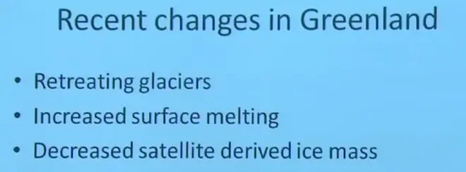
To wrap-up I wanted to?summarize some of the changes that are occurring in Greenland. Here are some of the glaciers coming off of the main Greenland Ice sheet as a function of time from 2000 till almost the present day. We looked at the Jakobshaven one.?

I did show you the Petermann up in the northwestern part. For the most part these are negative. Some very strongly negative, some not so strongly. But generally the glaciers are retreating. This is in units of square kilometers. So the base of it, it's not keeping track of thickness now, but the area as it decreases.?And we saw Petermann's glacier. So when that drops off, they decrease the area estimate of the Petermann glacier. And some would argue well that's not a significant loss because that'll refill eventually, but that's how they've done the calculation. And then we looked at Jakobshaven before and saw that its calving front was retreating with time as well, and that shows up on the time plot also.

Now, there's another thing we can investigate about Greenland, and that is the amount of surface area up on the ice sheet that has melt water in the middle of the summer. So you can fly a satellite over, look down, and by the way light reflects off the ice sheet, you could determine whether or not the snow is wet--whether it's got melt water mixed in with the snow. And in 1992 the pale area was shown to have melt water in the warm season. And now, 2005, even this deeper red area. It's only the diminishing white area that is free of melt water, and that's an indication that the climate is changing as well.
What happens to that melt water, some of it just stays there and refreezes the next winter. Some of it runs off in this rather remarkable phenomenon called a moulin, which is basically a hole that develops in the ice sheet that allows surface waters that are melting in the summer to drain and fall a distance of perhaps a kilometer or so down to the base of the glacier. And then it'll flow along the base of the glacier out to the sea. So this is an example of one of those moulins. Up on the Greenland ice sheet, water then draining down into this hole that takes it down to the bottom of the glacier.
Satellite Measurements of Ice [00:11:23]

Recently we've got a new technology to keep track of what's happening to Greenland and other things around the world. It's called the GRACE satellite, and maybe you can make out the acronym here. Gravity Recovery And Climate Experiment.?And it consists of two satellites moving around the planet very close to each other with a laser beam going from one to the other doing accurate laser ranging. So you know within a millimeter or so the distance between those two satellites as they move.
As the Earth is not uniform in its density, the continents have mass, other things have mass concentrations that make the gravity field of the planet a little bit irregular. And by sending a satellite around that feels that gravity, and keeping track of how the distance between the two satellites varies during the orbit, they can map out these gravitational anomalies around the surface of the Earth. And this is an exaggerated--what they've done is take a globe, and in three dimensions kind of made it nobly so that it shows you where the higher mass concentrations are.
So this kind of irregular gravity field is what GRACE can detect as it goes around. Now that satellit’s been in orbit for a few years now, and one of the applications of it is to look at not just the gravity concentrations near Greenland, but how they've been changing in time. That's what shown in this diagram.

So two plots are shown, one for Southeast Greenland, that would be this area here. The other for Northwest Greenland up here. The time runs from 2002 to 2010, and this is the centimeter of water equivalent thickness removed from, or missing from that part of Greenland over that period of time. And for Southeast Greenland, putting a straight line through there, you get about minus eight centimeters per year of water equivalent loss. And for Northwest Greenland it's about minus seven centimeters per year. So the two values are roughly consistent. That tells you that the overall mass of the Greenland ice sheet is decreasing.
Climate of the Last 5 Million Years [00:15:57]
We're going to talk about how climate has been changing with time. And for this you should be reading Chapter 13 in your book.?I've made a decision to focus on the last five million years.?
There are really three reasons for that.?
One is the continents have pretty much been in their present position for the last five million years. So we don't have to worry about the continents moving around.
Second of all, this has been the period of time in our planet when humans have been evolving to our current form. So it's not so distant in the past that we're not engaged in it as a species. This is a period of time when we have been coming on to, evolving to our present form.?
And I guess third, we're looking for a period of geologic history where there's been significant change in climate in order to make the subject interesting. But also, one of the reasons for studying past climates is to provide a context for future climate change. And to provide a good context for future climate change, you would like to look at a period of Earth history that had significant climate change.?

This is the geologic time scale. The Earth is something like five or six billion years old. This goes almost back to that level. The Precambrian is where we didn't have life in the form that would leave a fossil record. Nothing with bones or shells or anything like that. There was life there, and there's certain types of physical fossils that are left, but not the actual remains of the organisms.
Then you go through a series of rapid evolution as you come up through to the present time. We're not going to talk about dinosaurs. The dinosaurs died out right about there. Probably with an impact from a large meteorite. Instead we're going to focus just on these last three periods. The Pliocene, the Pleistocene, and Holocene, taking us from approximately five million years up to the present.
The continents are going to be in their current state for this last five million years.?If a continent has a record of a different climate, it's not because it was at a different latitude. It's because the climate was actually different on Earth at that time, not just the continents sliding around under the climate zones.

So just a few words about these three periods. The mid-Pliocene, 3.3 to three million years before present, similar common locations today, but a significantly higher global temperature, maybe two to three degrees Celsius for the average global temperature. Much more remarkable than that, though, was that the high latitudes were much warmer than they are today. There was a little bit of ice on Greenland, but not a real ice sheet. Because of that lack of ice, sea level was about 25 meters higher than it is today.
And for these reasons, there is quite a flurry of research going on right now about the Pliocene, because it's a possible analog for what the Earth will be like about 100 years from now with global warming. This idea that maybe there was a period in the past we could look at to see our future in a sense. Now whether that turns out to be an accurate analog, I would say remains to be seen. But that's one of the reasons why there's so much current activity about the Pliocene.
So a million years before present. A million years before present. These are some of the mammals we had in the Pliocene era. Saber-toothed tiger and the woolly mammoth.?

The author wanted to make the point that the normal forests that we have here at mid-latitudes, at that time extended all the way up into the Canadian archipelago up into Alaska. Areas that are now tundra had forests very much like the ones we have here in Connecticut. So it really was a period of time when temperatures were much warmer at the higher latitudes than they are today.

Then we'll jump to the Pleistocene, which is 2.6 million years ago up to just 12,000 years ago. One of the problems with Paleoclimatology is we've got to deal with these vast stretches of time. It's a little bit hard sometimes to conceive of how long ago that was and how recent this was.?
The Pleistocene was possibly the coldest period in Earth history, although there have been discussions of periods of time hundreds of millions of years ago that may have been colder. But at least in recent Earth history, in the last, say, 100 million years or even 200 million years, probably this was the coldest period in that part of Earth history.
As we'll see, there were lower carbon dioxide concentrations in the atmosphere than there are today. And throughout this two and a half million year period, there were periodic advances and retreats of ice sheets and mountain glaciers. So it wasn't a single ice age, in a sense it was a large number of ice ages with warm--brief warm spells in between. If you averaged, however, it certainly was a very cold period of time.?Surprising, because we just came out of the Pliocene, which was warmer than it is today. Then we go into the Pleistocene, which was much colder, and then we're going to bounce back out and talk about modern climate.
I've written here Milankovitch pacing because the advance and retreat of these ice sheets seems to have been controlled by slight adjustments in the Earth's orbital parameters. The so-called Milankovitch theory of climate change.?And this period of time, 2.6 to the present, includes most of human evolution, at least the species that have homo in front of them, as I'll show you in just a minute. And the Last Glacial Maximum, the last of these ice sheet advances, was about 14,000 years before present. And tt was just after that that I'll take the official end of the Pleistocene period. So I'm kind of defining the end of it as being the end of the last glacial advance.

It happens to be data from a Vostok ice core, and I will describe later how this data is gathered and interpreted. But for the time being let's take it at face value. Here's a plot of temperature change from present, from the present day back to 400,000 years ago.
So here is today, and of course by definition, present change--temperature change from present, that's right about zero, because here's the present day. About 10,000 years ago and earlier, we were in a much colder period of time. That's the last glacial period. Then there was another brief interglacial period, about 130,000 years ago. Then a long glacial period, another brief interglacial, and so on.
So when I talk about the Pleistocene as being a period of ice advances and retreats and significant climate change, this is what I'm talking about. On average it was much colder than the present day. Typically four or five or six degrees Celsius colder than the present day. But there were other interglacials. There are other brief periods of warmth. We're in one today, and about every 100,000, 125,000 thousand years back through this record, there was another brief interglacial. That will give you a sense for what I mean by this great variability that occurred within the Pleistocene period.

At the Last Glacial Maximum, in other words, right about here, about 20,000 years ago, although you could take it a little more recent than that, LGM, is the abbreviation for Last Glacial Maximum, this was the distribution of continental ice sheets.?
It doesn't show Antarctica, but Antarctica still had its full ice sheet at that time, and Greenland. But now look, in addition, you've got an even larger ice sheet over North America called the Laurentide ice sheet. And then a large one up over Scandinavia and Northern Russia as well.?So the number, or the aerial extent of large continental ice sheets was much larger 14,000, 15,000, 20,000 years ago than it is today at the end of the Last Glacial Maximum. So really a dramatically different climate then we have today.

Then the third geologic period that I want you to be familiar with is the Holocene. This is defined as a period from 12,000 years before present to the present day. It is a current interglacial period. In other words, the current non-glacial period. It has modern humans, so development of agriculture, a nearly constant climate, and nearly steady sea level during that period of time. So if you're looking for a reference point from which to consider or compute climate change, this is a possible candidate. Now, it's only 12,000 years, but still, that's quite a large time.

Here's a plot of the Holocene temperatures. This is thousands of years before present, so this goes back to 12,000 years, which is the beginning of the Holocene. Temperature--there's a lot of different proxies that are considered here, and they all give somewhat different interpretations of past climates. But if we take a look at the thick black curve, which is the average of all of the different proxies, here we are coming out of the last ice age, reaching a value about 10,000 years ago, which remains roughly constant till the present day.
Geomorphology [00:34:30]

So that's step one, getting those three time periods out on the table. There's lots of paleoclimate methods. I want to spend the rest of the period today talking about geomorphology. That is looking at the landscape to deduce past climates.?I'm going to focus on surface evidence of the Pleistocene ice ages, and look particularly at these five geomorphologic features.

A terminal moraine is that pile of debris that marks the end of a glacier. Remember, a glacier is moving, carrying material along underneath it, melting at the front. So it's like a conveyor belt. It's bringing material and then the glacier leaves, but the material piles up.
So if a glacier has a fixed terminus for a number of decades, it will build up a pile of rubble, rock, and soil at the end of it. And then if that glacier were to retreat, you'd have no glacier here, but you would have that terminal moraine left as a marker, as evidence of where that glacier was. It shows you where the previous end of a glacier was, if it was there at least for several decades or a few hundred years.

Here's a mountain glacier coming down into a lake, and here at the other end is the terminal moraine. So at an earlier time, this glacier filled in the lake and ended right there, and the debris it was carrying underneath it piled up to form that moraine. So we see it today, we can say ah, that glacier has retreated because it's snout used to be right there at that location. That's the beauty of the terminal moraine. It gives you this recent history of how far the glacier had extended.

Now, there's some other things that happens underneath a large ice sheet that get revealed when the ice finally melts and moves back. But a?glacier never moves back. It's terminus may retreat, but the glacier, the ice itself, is either stationary or is moving forward.
When you go into a warm period and the glaciers retreat, they never do it by sliding that glacier back up the valley. Be very clear on that. It's only that the apparent end of it may seem to move back. But the ice will continue to be flowing from left to right here as the terminus moves from right to left. So be very careful about your terminology on this.

Here's a terminal moraine left behind by that. There's an esker, that I'll define in just a moment, and there are some drumlins that I will define in just a moment. An esker is a river flowing underneath the ice, underneath the ice sheet, that gets partly filled up with debris. And then when the ice sheet melts, you're left with this little pile of debris where the river was. So the river, instead of being a depression in this case as we're used to seeing, because there was a river up inside a glacier, actually leaves an elevated tongue marking where that river was.

Here's a nice example of one up in Manitoba of an esker. So an ice sheet covered this, there was a river underneath the ice, and the debris that collected in that sub-ice river, then when the ice melted away left you with that esker.

Glacial striations, you can see them here in New England, scrapes on bedrock indicating that a glacier has slid over that particular part of rock. Usually underneath the ice there are chunks of rock embedded in the ice. And so you're scraping these embedded chunks over the bedrock, leaving a scraping mark. You can tell what direction the glacier was moving. Well it's hard to distinguish that from that, but at least you know it was either moving in that direction or in that direction from the direction of those glacial striations. Sometimes they can be deeper grooves, as you see in this piece of rock here. So that tells you that a glacier has scraped over this terrain.

The glacial erratic are easy to spot. A very large boulder sitting on a bedrock that doesn't match it in terms of rock type. So it's foreign. It didn't come from here. It's been moved from some other place. Now, if it was a small rock, you could say well maybe water could have moved that.
But if it gets to be this size--there's nothing there for scale, but that's two or three meters in height--water could not have moved that large rock. So that had to be a glacier that moved it. The word erratic means it's a large boulder in a place that has different rock type than the boulder itself. So it didn't come from there, it was carried in by somewhere else. Sometimes you can trace these back and find out where they came from. That will give you a direction of ice motion.

A drumlin is a hill that has been shaped by a glacier sliding over it. It's got usually a steep end, and a less steep end, indicating the ice flow, in this case, goes from left to right. So it scrapes off material here, and then deposits it on this long tail back here.
Last Glacial Maximum [00:42:51]

So I want to spend a few slides just describing what the Earth was like during this Last Glacial Maximum. Roughly 20,000 to 14,000 years before present.
In addition to Greenland and Antarctica, there was this giant Laurentide ice sheet. An ice sheet on the West Coast called the Cordilleran ice sheet. But look, Alaska was, at least Northern Alaska was still free of ice. That's a bit of a surprise. However, there are also large ice sheets in Scandinavia and Northern Russia as well.

When you look at the drumlins and the glacial striations, and the glacial erratics for the Laurentide ice sheet, you can work out a sense of motion, how the ice was moving, and this is what you come up with.?That's the Laurentide ice sheet.?The little arrows indicate what local evidence tells us about the direction of motion of the ice sheet. Down in our part of the country, it was from north to south. But up in Northern Canada actually, south to north.
Stable Isotopes of Water [00:46:11]
Well now, we need to get a little more quantitative about climate change.?We have to have records that we can go back uniformly in time to see how things are changing quantitatively.

One of the best ways to do this is by looking at the stable isotopes of water. And I wanted to remind you about what I mean by isotopes and how we're going to use them climatologically. You remember that an isotope of a chemical element is defined as an analog to that element that has an extra neutron or more in the nucleus to give it an added mass, but without any change in its electrical charge.
So for example, hydrogen is normally one proton with electrons going around it. The most common isotope of hydrogen is called deuterium. It has a proton and a neutron in its nucleus, so it's got double the mass, but the same charge. The same charge means it behaves chemically like its parent. But that extra mass makes it behave a little bit differently when it comes to changing phase.
With oxygen, the dominant, let's say the parent isotope of oxygen has a mass of 16. Eight protons, eight neutrons in the nucleus. However, it's still oxygen if I add two more neutrons to the nucleus. Now it becomes oxygen 18. These are the particular isotopes I'm going to be talking about next time with respect to using--looking for clues for climate change, particularly deuterium versus hydrogen, and oxygen 18 versus oxygen 16.
So I can make up new water vapor molecules now. If I make water from a normal--two normal hydrogens and a normal oxygen, it's going to have a mass of 18--16 plus 1 plus 1, that's 18. If I replace one of the hydrogens with deuterium, that's going to give water with a mass of 19. If instead, I keep the two hydrogens as hydrogen, but replace the oxygen 16 with oxygen 18, I get a mass of 20.
Turns out that these heavier isotopes of water have a slightly lower vapor pressure. This means they evaporate more slowly and they condense more readily. And this is what gives them—what provides to us information about how the hydrological cycle was working in the past by looking at the ratio of these two isotopes.
